Harper Creep Falls

Harper Creep Falls
Harper Creek Falls

Sunday, November 5, 2023

The Channels

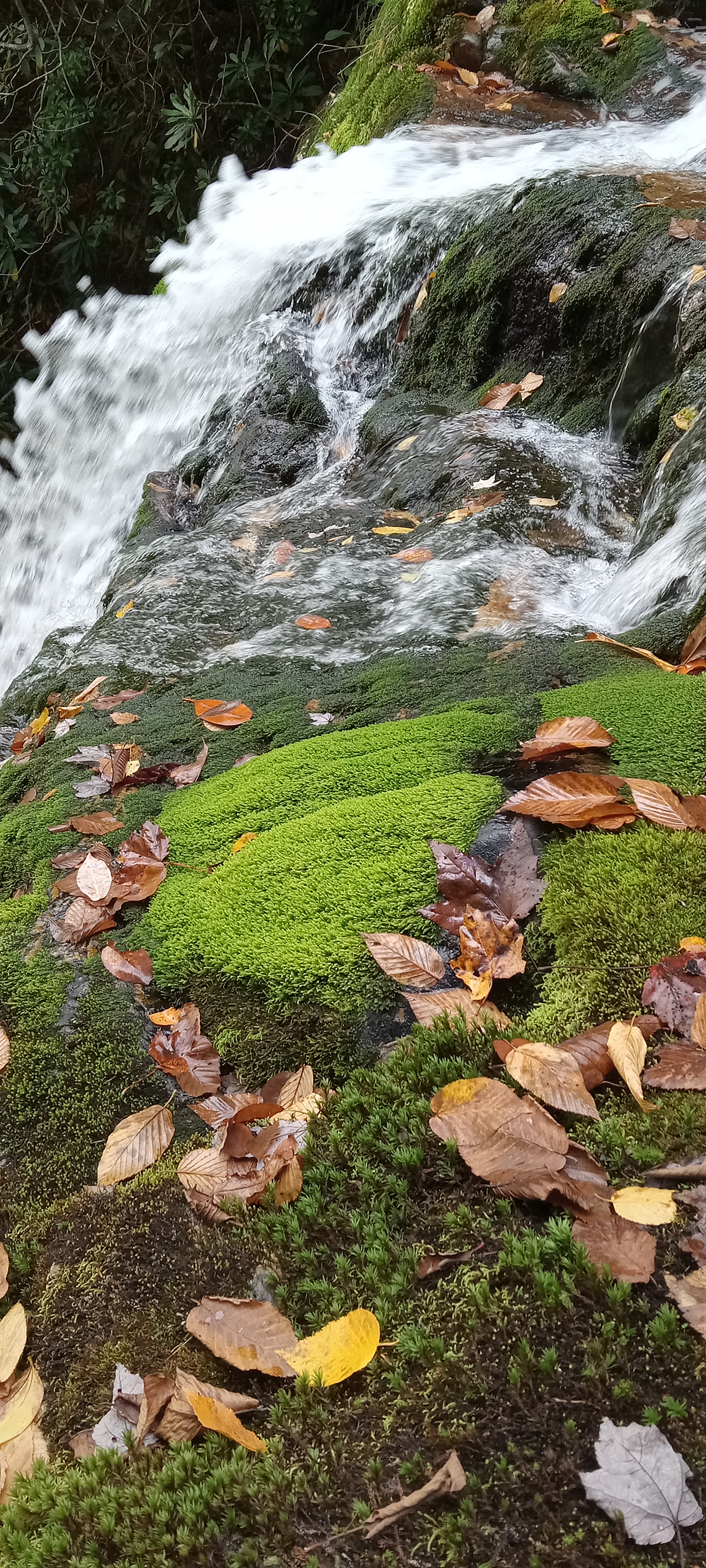
It is amazing how fast we transitioned from beautiful Fall colors to Winter bare branches in the mountains. A combination of exceptionally fast change in temperature that were in the teens last week along with a few windy days brought down most of the leaves. The woods we hiked in yesterday were nicely clear of underbrush and the predominant green harbingers were ferns scattered abundantly about the forest floor.


We had taken two vehicles with five of us, but there was only one parking spot when we arrived at the shorter route into The Channels. You were not even allowed to park legally down slope and walk up to the trail entrance per the posted Ranger. We opted to not go that route. Instead, we went around to the longer route. This other, older trail, The Great Channels Trail, was reported to be 11 miles roundtrip. However, it is hunting season, so two gates were open, and we were able to drive 2.1 miles (4.2 miles roundtrip) up the gravel road. My hiking partner GPS measured that we hiked 6.7 miles in total, barely farther than from the other end and far less traveled. Part way up slope, we came upon this curiously shaped limestone boulder. My first thought was that some giant hand had plunged into the soft, wet clay to form the large "eye socket" hole.


It appeared that there may be some good climbing on this boulder.


The way was not steep be it was continuous. Here we take a break. You can see both how young and how open the woods are which is an odd combination. Usually, young growth has abundant briars and brambles and all such herbaceous and low, woody stemmed varieties. Perhaps it is a function of this being the northern aspect or perhaps the trees grew so thickly as to shade out the understory. I don't know.


He turned before I could take the picture. The sky was absolutely cloudless when we started, but it slowly clouded up.


My son's map informed us that the flat-topped mountain is Clinch Mtn.


It would take very little to restore this tower for climbing, but I guess most people can't be trusted to take care, so the bottom run of steps is missing and the next run is missing the risers.


For all of the clearness of atmosphere, there was a haze down low, partly Nitrous Oxides (brown combustion haze that reaches up to 4500') and partly a forest fire off to the South.


The top of this mountain on which the tower stand is significantly flat and yet the sides are steep sided.


Picture of the Day! Brother and Sister on the left, me, my son behind me, and my most frequent hiking partner on the right


What is our next move?


There are so many parallel ridges in the Ridge and Valley Province. The sign reveals that we are at the entrance to The Channels which sits just off the peak of the mountain.


The sandstone cap to this mountain is cracked at right angles into a maze of passageways 10 to 20 feet deep and inches to perhaps 8 feet wide.


Bro and Sis stand in what I would call the entrance and main hallway of the maze. 


Some of the passageways are just wide enough to tempt you to explore and some even needful of removing you pack to penetrate. I was fascinated by the pancake shaped plate over some of the passageways and chocks jammed here and there in the gaps.


One pancake covering rock induced me to go up top to inspect. On top I saw this little tree prospering where it was planted. It is a little hard to discern from my picture, but the base of the tree is perhaps 15 feet below the foreground moss.


You see my friend is at the edge of the boulder field.


Other places it was not so easy to immediately find the way out.


Did years of my picture taking cause my son to pose so uniquely? (see earlier fire tower picture)


I wished that I had backed off a bit. Through this curiously shaped hole I could see white sandstone stained with iron oxide.


At the bottom end of the boulder field the height was more than 25'.


These two chock stones look very precarious.


The definite plane at top and bottom of this odd column are singularities between sandstone at the top and bottom and limestone in the middle.


Somewhat protected from rain and sunshine, it is still amazing how well the year of construction and elevation (as well as foreman on another angle) have stayed intact. 


Perspective is everything in photography.


Here probably placed by another explorer is a second example of the white sandstone with an iron oxide layer.


Following are the good pictures taken by my hiking partner. A combination of his superior camera, the unique natural lighting at just this moment, and the crazy chockstones make for some really good shots. My son suggested that I kick one of the chockstones. Though weighing many tons, you feel as though you could dislodge them upon yourself.


I wondered when I was taking my picture why the rest of the group was taking pictures of me. I think it was the startling lighting.


I observed to my hiking companions that even at 63 years old, I still feel excited like a child about curious new places to explore, observe, record, and play in. Perhaps I have a heightened sense of curiosity, but I feel as though when unblunted it resides within all of us, a God-given desire to discover Him through the beauty of what He has created. Because "The heavens are telling..." (Psalm 19:1ff) and "since the creation of the world His invisible attributes, His eternal power and divine nature, have been clearly seen" (Romans 1:20), I guess I'll keep looking and enjoying it and Him.

Sunday, October 29, 2023

A Lovely Weekend

Our son, his wife, and their daughter came to visit for the weekend. I caught this before bedtime reading of an old classic, "The Little Engine That Could". To think how this was a reenactment of many years previously with one or several on my lap or around me on the arms and back of the chair.


On Sunday afternoon, after church, we went to nearby Steele Creek Park. I am very thankful that his picture turned out so well, because I attempted to take many other pictures at the park, but my cellphone camera (1) did not work. The picture partially reveals some amazing characteristics of the park. Two parallel ridges that run the 12-mile length of the park, cleaved at about the midpoint by a stream which has been dammed up to make a lake. From the vantage point of this picture, you can see Holston Mountain in the far distance. My son's family makes a handsome sight, and it is growing (2).


We also walked over a large, grassed area to a playground. Our granddaughter is particularly fond of slides. We walked by the lake, watching the ducks, all the while enjoying the pleasantly warm and sunny day. We took a short ride on the small gauge railroad.

On Monday morning, we went to The Cave (3). If you are a frequent visitor to my blog, then you know this cave. I told the owner that I may need to buy stock in the cave because by the time that I bring all my family members, I will have been there many times. The sinkhole entrance has caved in at some previous point. When made into a commercial cave, the first chore was to clear out many tons of trash, for it had been used as a dump for many years.


The three different tours that I have had in the cave have been done by three different people. The first one was very geological in nature, the second one was historical in nature, and the third one was comedic with a generous sprinkling of random cultural, historical, cave passage, and governmental trivia. The formations in this cave are not so beautiful as others I have seen in other caves, but there is a good variety with a preponderance of long dripping cracks.


The modern LED flashlights make picture taking more possible. The colors range from white (mostly calcite) to black (manganese compounds), green for algae growing on some formations because of previous incandescent lighting (4), pinks and purples for small impurity minerals, terracotta clay layers, ubiquitous gray of the limestones, and glowing colors of minerals under blacklight.


This 140' passage is the most beautiful of the cave. If you pound your feet, it resounds with the hollowness of a presently undiscovered passage, they say.


I am glad to see that momma keeps little one warm. This is in the tallest room with a ceiling of up to about 40'.


The creek is 170' below the surface at one point. It exits out yonder entrance, allowing very much exchange of air and healthier bats (5).


Here you can see some of the algae mentioned earlier.


There is one pleased daddy! This part of the cave where you descend and ascend from the sinkhole shows significant past waterflow. Since even the most drastic recent rain events do not get more than a slight flow, it must harken back to the Worldwide Flood of Noah's day. Uniformitarianism simply does not explain many formations, including the growth rate of stalactites.


You should see in person the uniqueness and sharpness of some these formations, looking for all the world like sharks' teeth.


1. The electronics are glitching more frequently on the camera. Sometimes when I turn it on, the screen is majority white or at other times all white. I have to turn it off and back on to get it to work. Other times the screen flashes as it would when a picture is taken but no picture is taken. This is very frustrating.
2. Look closer if you don't see it, 13th grandchild on the way.
3. I have taken to calling it The Cave because this was the third time that I have been to Appalachian Caverns in a year. 
4. The tour guide this time, who is the owner by the way, says that now that there is LED lighting throughout the cave, this should remedy itself.
5. The tour guides tell me that it is the only cave around that has not had an infestation of White Nose Syndrome. They believe the exchange of air and generally drier conditions enable this boon.


Saturday, October 14, 2023

Red Fork Falls and Beauty Spot

A small tease just before the main course


The top of the falls is deceptive. It almost appears as though you could go down the face of the cascade. Evidently, many have tried and been badly injured or worse. We preferred to look and go around.


Based on the moss and liverworts, this must be a continuously wet cliff suggesting more water than we saw this day.


The falls is 100 feet high with a deep little pool and the base.


I enjoyed the bright, mossy greenery.


I like to explore. Can you tell?


In tumbles over the metamorphically foliated rocks in a narrow draw with overarching trees, feeling more isolated than it really is. 


This rock sluice below the falls was mesmerizing. From the top of the falls to several hundred yards downstream, the creek bed is almost nonstop bedrock with scarce gravel in one or two pools. In fact, the last pool we viewed was a solid rock bowl without any gravel or pebbles in it. The bottom had a bluish tint surrounded in the shallow by a thin layer of mud. Evidently, the current runs deep and keeps the bottom clean of silt and sand.


The yellow birch leaf looks shellacked as though for a leaf collection on the boulder surface. Note the identifying characteristics of double serrated leaf margin, little protruded point, and veins like a Beech tree.


Cascade a short distance downstream


... and another


... and another


We clamored up a tributary for perhaps 150 yards to see what other water paths of interest were there. Usually you think of water determining creek beds, but the slants and cracks of the rock definitely predominate the path finding of the water here.


The shelf fungi had a color and texture like calcite formations in a cave.


I appear to have chosen the easier side of the creek to ascend.


We found this unique little falls before turning around.


I see this little shamrock-looking plant in wet environments in the mountains fairly regularly, but I don't actually know what is called.


Spotted Wintergreen (Chimaphila maculata)


Rattlesnake Plantain just past blooming


A break in the trees along the gravel road opened up a memorable view, because the light green peak is Hump Mountain near the town of Roan Mtn, TN, my old stompin' grounds.


Bottle Gentian


Beauty Spot is a very accessible, open view. On any Friday, Saturday, or Sunday evening it seems as though half the local couples come to watch the sunset.


The view east is toward the more mountainous NC.


The end of a beautiful Sunday of worship and exploring. 


I don't know why I didn't take any pictures of the little hike up Unaka Mountain. Come to think of it, I did- Bottle Gentian- but I should have taken a few images of the melancholy spruce stand on the peak. The trunks are not large but somehow it looks old and undisturbed. These mountains are beautiful, and I enjoy sharing them with my young friend who is from the West Coast. They are so different than there and yet so similar in how the point to the infinite, powerful, kind Creator.