The contrasts between this time at Margarette and Bailey Falls and the previous excursion were many. First of all, the temperature was in the twenties when we arrived with considerable cold drainage coming down the gorge, as opposed to 40's to 60's the other time. We hiked quite quickly up the trail both to keep warm and because we could.
Instead of family members ranging from 6 to 74 and many in number, there were just us three. This bridge is where the draw becomes a gorge with broken cliffs rising higher and higher as the draw becomes narrower.
There were no leaves on the trees this time.
There was significantly more water.
That increased flow rendered the falls more awesome and with the temperatures the boulders were icy. I slipped and stripped off a sizeable piece of flesh from my shin. At that temperature I barely felt it, but it made up for it later. Oh well, the falls was certainly beautiful.
The young ones are quite the hikers. I especially had trouble keeping up with my partner's younger brother.
The bushwacking up to Bailey Falls was more challenging with higher water. We even placed rocks here and there for crossing. Some of our launch pads were moss, water, and ice covered and slanted poorly for a safe, dry return. This figured into our later plans. The walls on either side of the approach are not more than 25 feet but the narrow notch is picturesque and intriguing.
The increased flow and sun rays through the mist were much more beautiful than I was able to capture.
It fascinates me to be able to straddle the top of a waterfall, even if it is only about twelve feet tall.
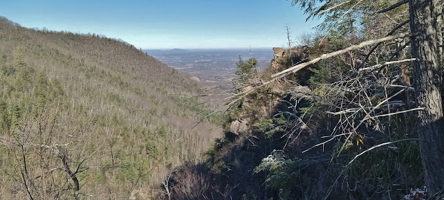
It was at this point where the two hikes diverged more extremely. I suggested that the odds of crossing the creek the numerous times needed for the return trip, where treacherous launches would be worse landings, was fraught with injury and cold wet potential and that we should go along the side of the ridge past the cliffs and then descend back down to the creek. Here is a view the cliffs we were enable to get past, and the valley beyond.
Between the brambles, rhododendron and laurel thickets and cliffs scattered all along the ridge slope, we decided to go cross over the top of the ridge and try the far slope. Here is a picture from the top of the ridge toward a higher, snowy ridge to the east.
Next, we went steeply down slope, though without cliffs. The heavy leaf litter obscured rocks and roots. I use a step resembling slalom skiing where you turn your boots perpendicular to the slope then reverse a few steps and hops later. When we had almost reached the other creek bottom, we came across an old roadbed with occasional rock walls to form the roadbed.
The reason bushwacking always gets a description but very few if any pictures is because it is hard to do justice to what it is like in a picture. The force and tightness of branches and brambles against your clothing and skin feels much tighter than what the picture suggests. And what can you really see anyway?
At last, we saw the new creek bed after an estimated 600 feet vertical traverse of a ridge of thickets.
It was much faster going down this draw, mostly along the roadbed, though fallen trees and briars blocked this path to a lesser degree. We subsequently came, as did the tributary we followed, back into the main creek and trail. My partner said that his GPS said we hiked 4 1/2 miles, but it felt like 9. His brother enjoyed the adventure but reflected that coastal Washington has thicker undergrowth, seeing as it is rainforest and all. We were just thankful for the opportunity to explore without serious injury. I do so love being out in the woods. God's Creation must have been ravishing before the Fall, and forest without thorns would have been good, too.


No comments:
Post a Comment