
Our plan was to go as high on the gravel roads as gates and terrain would allow. In our Asian compacts, the roughness of ground limited us. In fact, we went further than we wanted to because the track was truly narrow with no place to turn around. Finally at a switchback we parked and began our hike, far below where we had intended to be.

We were feeling energetic and the weather was good, so we started out on our adventure.
My daughter challenged her husband to stand on this old bridge, but he said that was crazy. She replied, "My dad is crazy enough to do it." So, I did. The log beams were fine for one or two people. I well imagine that it had supported mules pulling logs to the mill or ore to the processing plant at one time.

The buttress construction was traditional and had withstood many decades of stormwater in the scoured creek bed.

My daughter was impressed with the size of the Yellow Poplar shade leaves like the one in her left hand, which were larger than the Fraser Magnolia leaf in her in right hand. She is all smiles to be out in the woods hiking.

Creek just above the bridge

Up that same creek, we had heard dogs baying just moments before and then a shot. These local guys told us that their buddy had killed a bear. My son-in-law is observing with hands on hips. The little guy understood that I wanted to take a picture. He proudly held his toy gun up for me to see.

Obviously, a trail marker, but I don't know what trail it delineates.

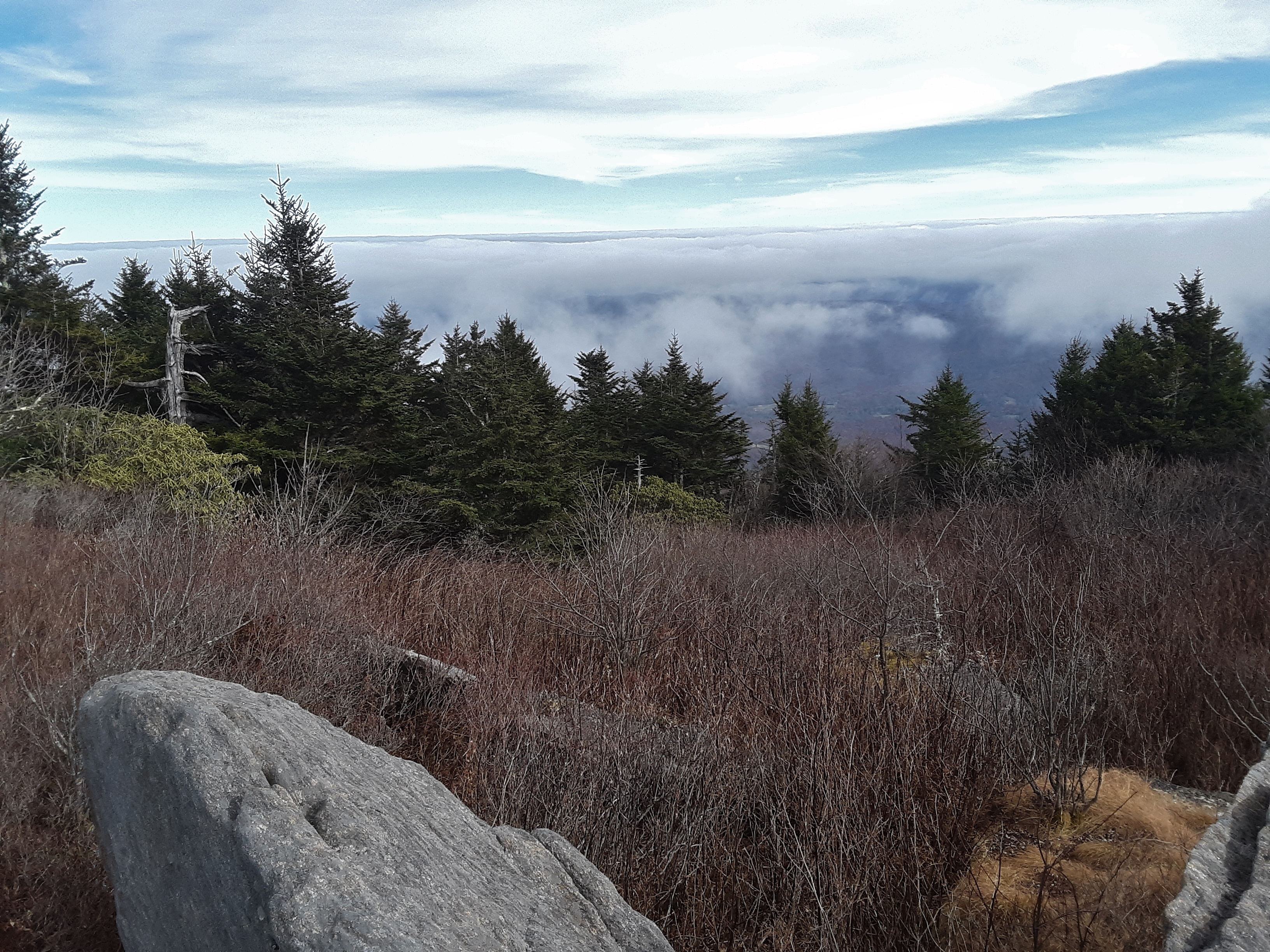
Looking south along the Black Mountain ridge

One thing the locals kept telling us to know we were on the right track was the upper grade. I did not understand what they meant until one said it had been a railroad grade just below the ridgetop. For that reason it was nearly level, but it ran some 600 feet below the ridge. I am guessing that it had been put there for logging the ridge and/or the mica, feldspar, lithium, and other minerals mined along this track. My youngest son was patient with our slow progress.

I was amazed at the extent of low, thick growth so high on the mountain. Why do trees not fill in the open spaces and grow to any height? Is it wind? Is it very poor soil from mine tailings?

Celo Mountain ahead!

Finally, we reached the Black Mountain Crest Trail. It goes around most of the actual peaks, avoiding constant up and down along the ridge. The peaks are mostly little side trails or manways through the bushes.

The hiking couple, daughter and son-in-law

The Siblings

And here is the manway up to Celo. The rock outcropping ahead is part of the "path."

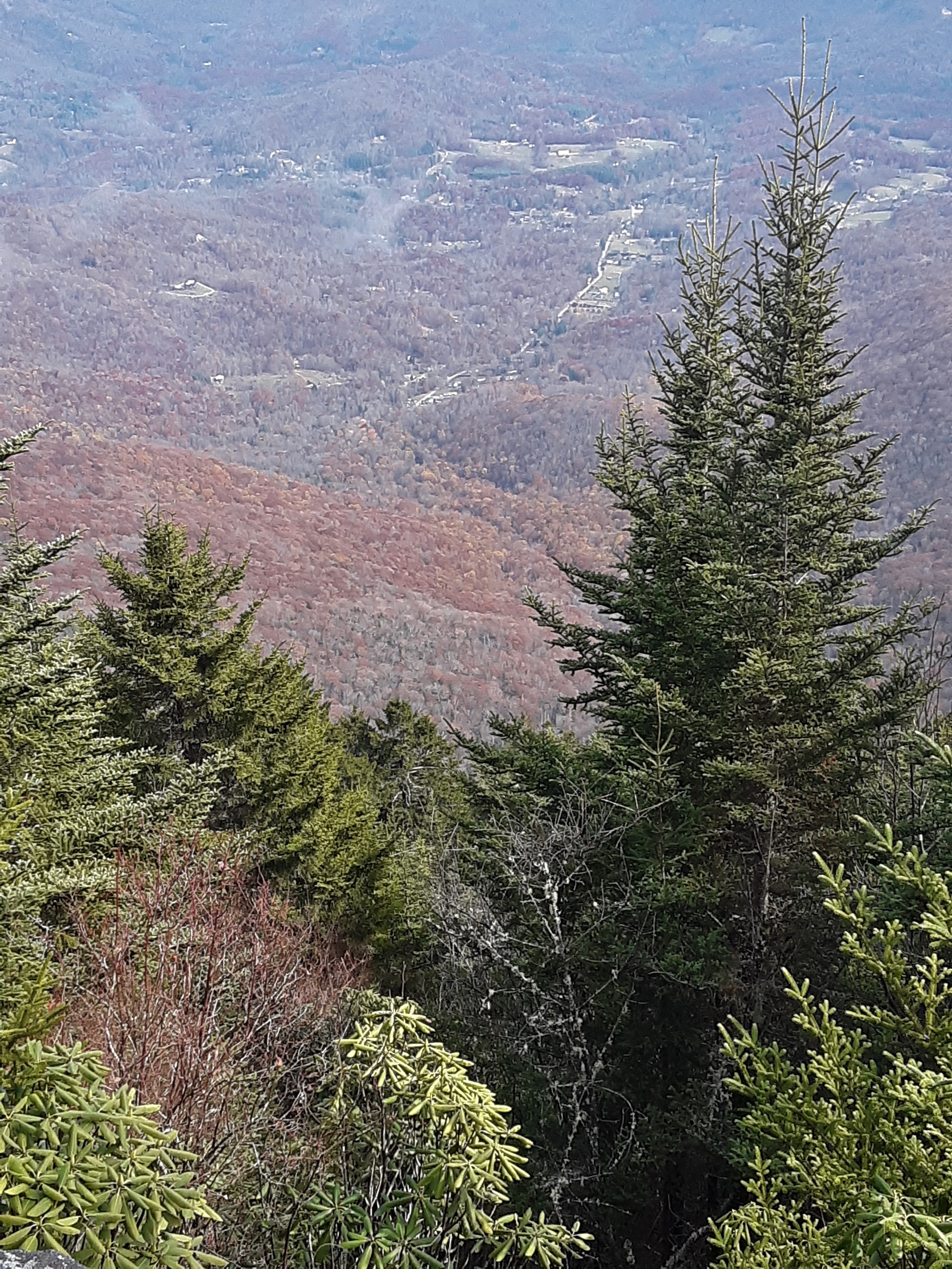
The view on top made you feel on top of the world, especially since many other places were shrouded in cloud cover.

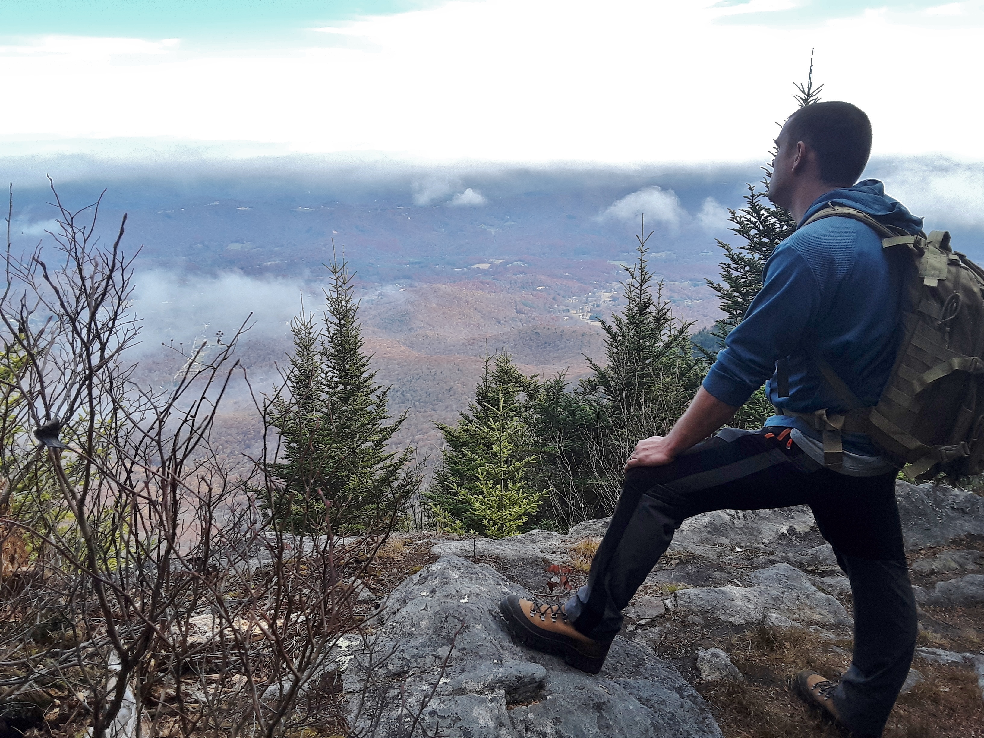
My son is contemplative, as was I. I sang a verse of a hymn after the others left. Grandeur should always elicit praise, for God is a great Creator and kind Father.
I am happy and thankful to still be able to hike enthusiastically and enjoy the beauty yet again. These mountains are in my blood. I find comfort and joy in struggling up and down them and observing their various seasons and moods.

Some benchmarks can be a bit hard to find.

Another one reached

Had we come up the other side, the elevation gain from this road below was said to be over 3000'.
My son-in-law enjoys the woods, too.

Things have certainly changed since I started hiking in the mid-seventies. Hike along, call home to check in with the wife, continue on.

A snack break in the shade before bushwhacking to the next peak

We could not find the benchmark on Gibbs Mountain. It turns out that there is not one, because you can see them all at the USGS site (National Geodetic Survey Data Explorer (noaa.gov))

Best view from Gibbs

Shag carpet of moss

Celo Knob is what the peak is called, though the whole mountain is called Celo Mountain.

View from High Rocks

I was amazed at how much low, shrub growth there was as if recently fields.
You could tell by several of the gullies that water really rushes off the top of this mountain.

There was a 1/2 acre Ground Cedar patch in the woods, the largest I'd ever seen.

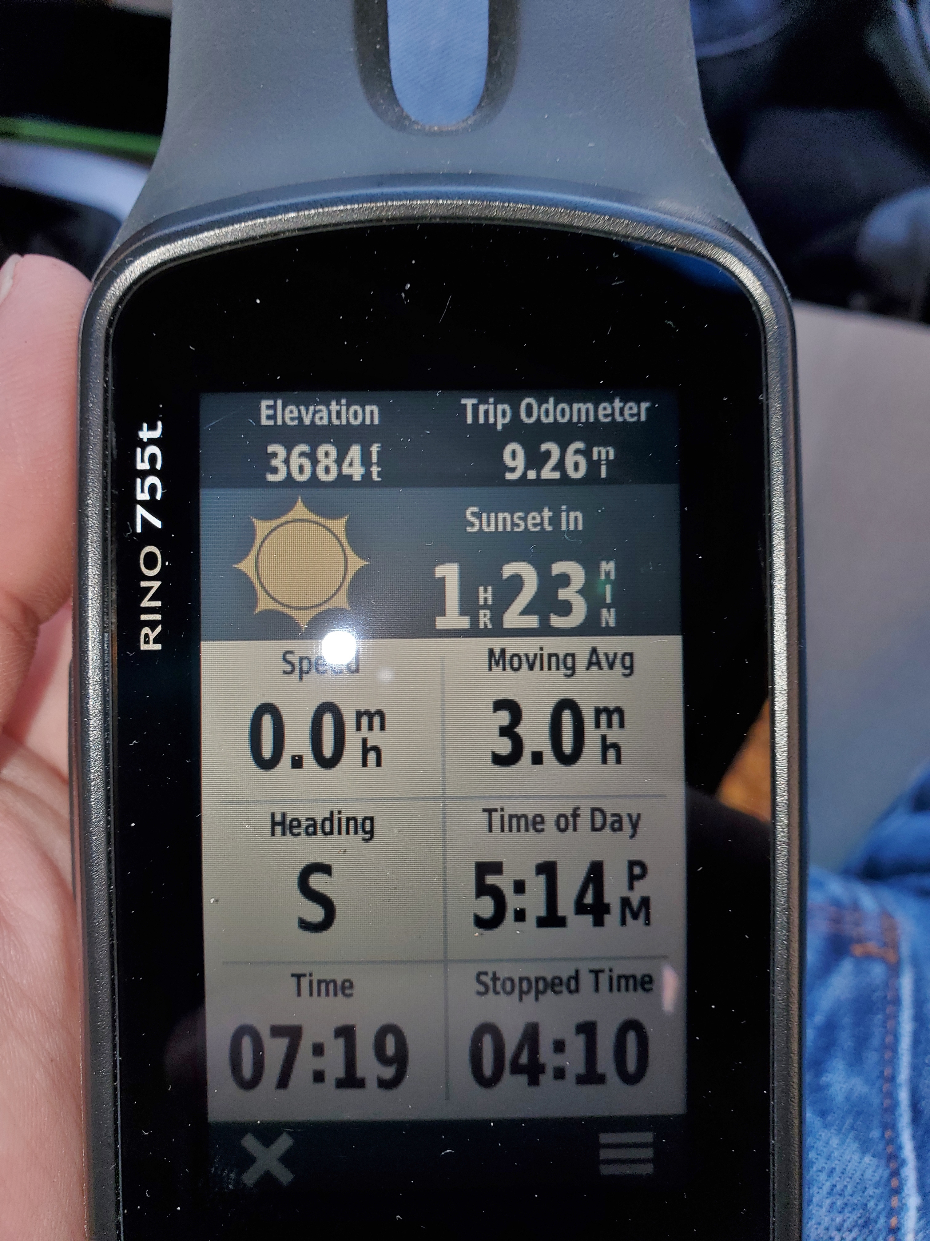
My son-in-law's GPS unit shows 9.26 miles and 3684 ft. elevation gain. I think that the stop time, and therefore the moving average speed, are bogus.
The after hike supper was in a Mexican Restaurant. My family thought that I was crazy when I started gushing over the wooden walls. "It's Wormy Chestnut!" I said. That is rare and crazy expensive. "How do you know?" was the reply. The grain pattern, color, and wormholes are very distinctive.

Yet again, we enjoyed God's Creation and had but a bit of soreness and tiredness to show for it.
No comments:
Post a Comment